
Hurricane Ida made landfall on August 29, 2021 as a Category 4. It served as one of the greatest tests to the Hurricane and Storm Damage Risk Reduction System (HSDRRS) since its construction. Approximately 159 Flood Protection Authority-East staff members worked before, during, and after Ida’s arrival to operate the system. Despite noteworthy storm surge, the levees, gates, and pump stations that make up HSDRRS functioned as designed, keeping flood waters out of Orleans, East Jefferson, and St. Bernard parishes. Inspections of the system began as soon as conditions were safe to identify any minor damages and begin preparing for whatever storm may come next. Below are a few facts, figures, and images regarding Hurricane Ida and the FPA-East’s response.

Photo: National Weather Service

Photo: National Weather Service
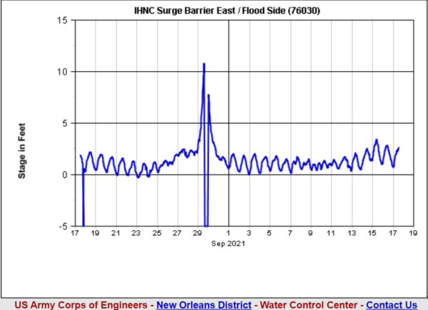
Below are graphs depicting surge levels at different structures within the system. Included are the figures that go alongside those graphs.
Lake Borgne Surge Barrier
- Flood Side: 10.84+ ft (the gage malfunctioned during the storm which is why we do not know the exact total, merely that the surge was above 10.84 feet)
- Protect Side: 2.46 ft
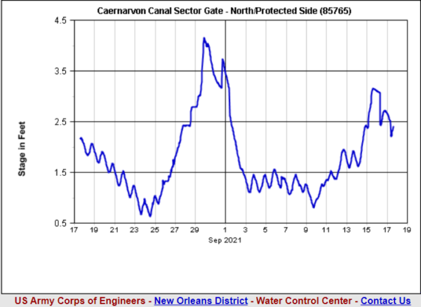
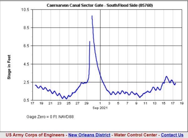
Caernarvon Sector Gate
- Flood Side: 13.1 ft
- Protected Side: 3.99 ft
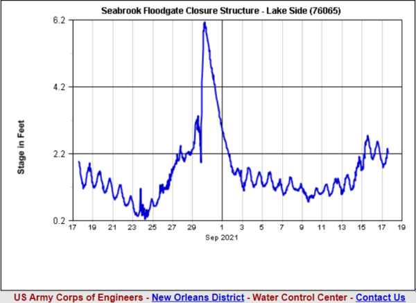
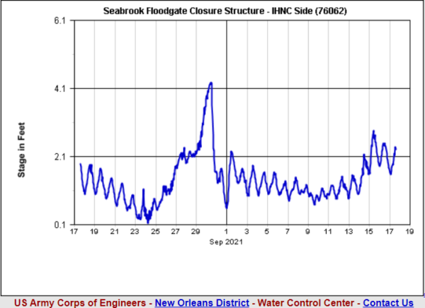
Seabrook Sector Gate
- Flood Side: 6.05 ft
- Protected Side: 4.16 ft
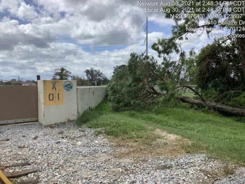
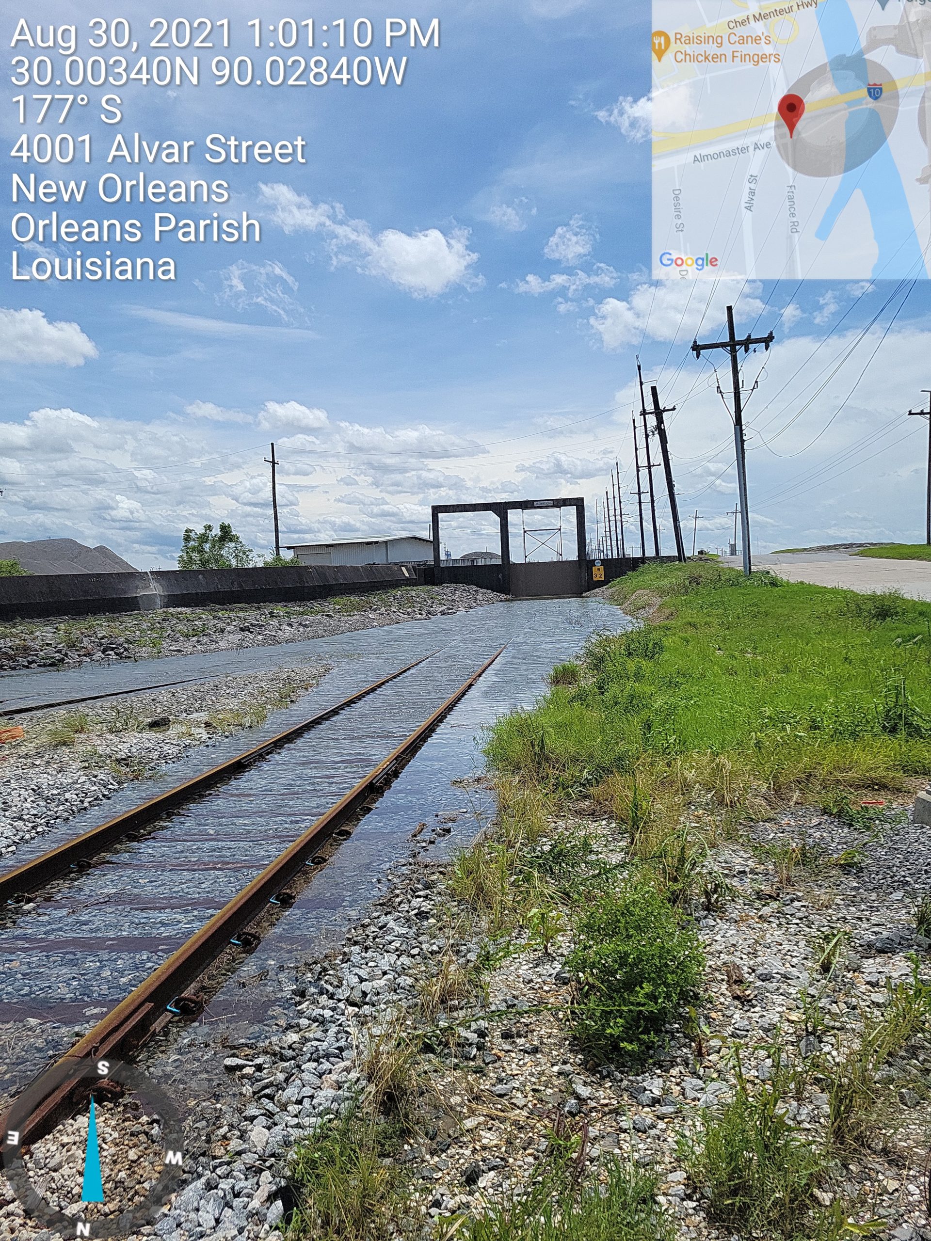
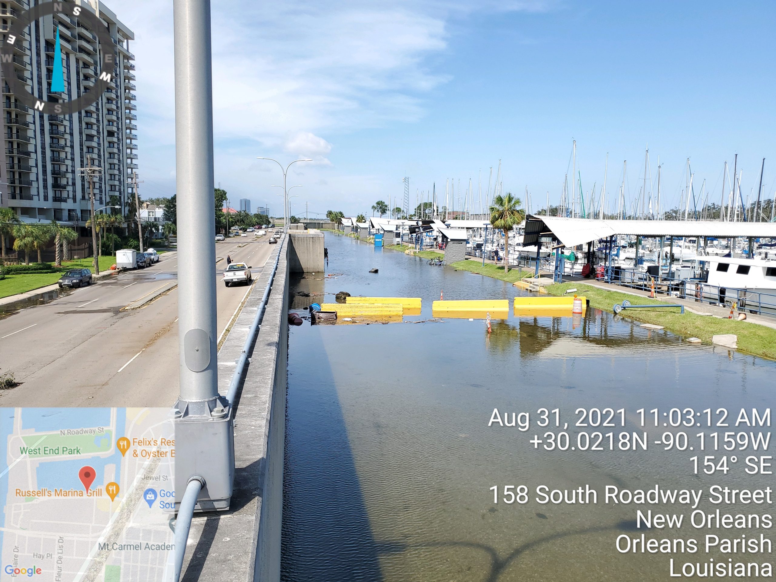
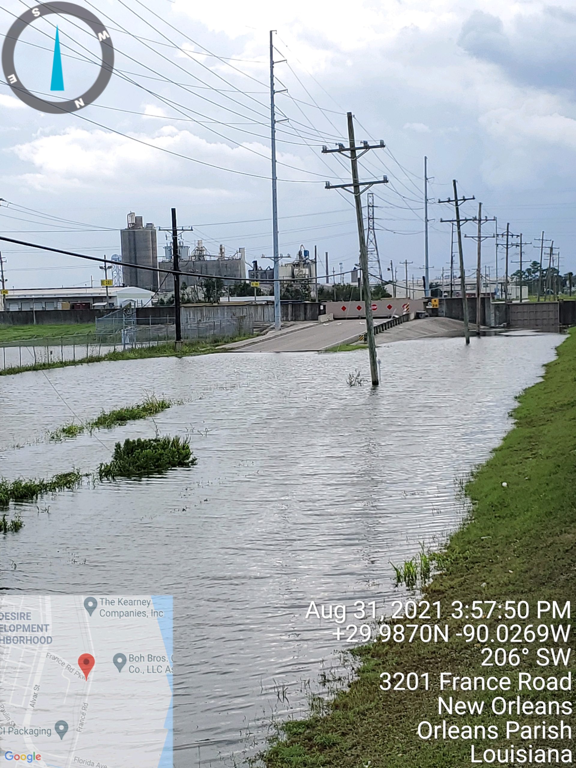
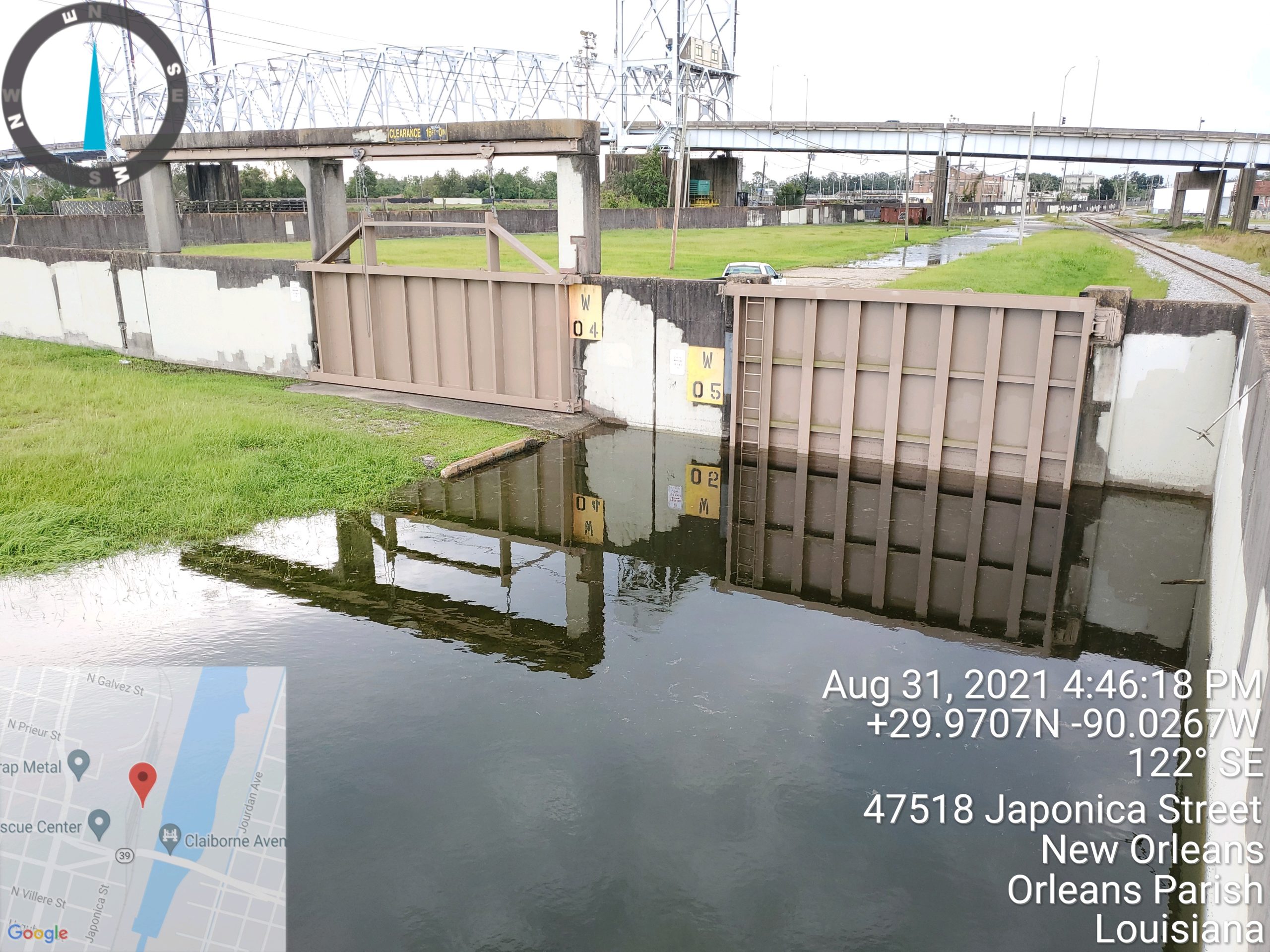
Below are photos taken by FPA-East teams as they checked on system structures post-storm. You can also click the different icons on the map to see where each of these photos was taken.